Erik Lin-Greenberg and Theo Milonopoulos on how commercial satellites are upending conflict. This article appeared here in Foreign Affairs.
Days after Russia began its invasion of Ukraine, Ukrainian President Volodymyr Zelensky delivered an emotional address to the European Parliament, pleading for support. That same day, Ukraine’s vice prime minister and minister of digital transformation, Mykhailo Fedorov, took to Twitter to announce a more targeted—but no less urgent—plea to the executives and corporate board members of commercial satellite companies. Specifically, Fedorov appealed to several leading private satellite firms to provide high-resolution imagery “in real time” to the Ukrainian armed forces to assist them in fending off Russian aggression.
As we wrote in 2021, commercial satellite imagery is dramatically changing the information landscape, particularly when it comes to national security. Gone are the days when only governments could collect advanced intelligence about their rivals and when militaries could keep information about battlefield developments concealed from public view. Now, members of the public can use commercial satellite imagery to reveal activities some governments would rather keep hidden. They have documented North Korea’s expanding nuclear arsenal and exposed human rights abuses such as China’s detention of the Uyghur population in internment camps. In Ukraine, a multitude of actors, including private satellite firms, think tanks, journalists, and amateur sleuths, have used commercial satellite imagery alongside other forms of open-source intelligence to reveal and verify information about military maneuvers, battlefield losses, and Russia’s targeting of civilians.
By openly providing information that once would have remained largely secret, commercial satellite imagery has helped galvanize public support for Ukraine, informed Ukrainian military planning and operations, and countered Russian misinformation. But these advantages do not come without risks: the United States’ friends and foes alike will seek to exploit the growing amount of information available to nongovernment users. The United States, its allies, and its partners might find their own sensitive activities subject to surveillance. Pro-Russian actors could likewise exploit open-source satellite information to undercut the Ukrainian defense. Commercial satellite companies could even eventually find themselves in Moscow’s crosshairs. As private satellites go to war, they are transforming the character of modern conflict. Although states still rely overwhelmingly on covert intelligence-gathering methods, Western governments should be sure to account for the opportunities and risks this evolving technology poses as they craft foreign and national security policy.
Knowledge is power
Accessible satellite imagery already appears to be influencing the US government’s approach in Ukraine. In the run-up to Russia’s initial invasion, the Biden administration disclosed intelligence about Russian deployments on Ukraine’s borders to its allies and the broader public, all but confirming that Moscow was planning an assault on its neighbor. This was an unusual move: governments are typically loathe to share sensitive intelligence about adversaries to better protect the sources and methods used to acquire information. But in this case, much open-source information about Russia’s military posture and potential next moves was already circulating in the public sphere.
Although much of what the White House shared was likely based on classified sources, the flood of commercially available information about Russian military deployments probably influenced the administration’s decision to disclose this intelligence by reducing fears that such a disclosure would jeopardize its sources and methods. Publicly available satellite imagery helped, rather than hurt, Western intelligence efforts: one National Security Council (NSC) spokesperson suggested that “open-source satellite imagery has helped shine a spotlight on Russia’s troop movements.” Nongovernment analysts and amateur sleuths could be “roughly on the same page” as the US intelligence community, according to one former NSC official, by triangulating commercial satellite imagery with social media posts. And the Biden administration’s efforts to consolidate and share information worked to its advantage: the White House’s disclosures likely helped convince skeptical European allies of the credibility of Washington’s information early on, laying the groundwork for a collective Western response to Russia’s invasion.
Beyond forcing states to navigate a changing information environment, open-source intelligence has proven instrumental for Ukraine on the battlefield. Information from nongovernment sources, for instance, has helped deny Moscow the element of surprise by tracking Russian troop movements and almost certainly has aided Ukraine’s targeting of Russian forces. In the words of one US intelligence official, commercial satellite imagery has helped give Ukraine an “information advantage on the battlefield [which] is so far countering superior equipment and mass.”
Much of this commercial satellite imagery has likely reached Ukraine as the result of partnerships between the U.S. intelligence community and private firms such as Maxar Technologies, BlackSky, and Planet. In April 2022, for example, the National Geospatial-Intelligence Agency (NGA)—the US agency responsible for collecting, analyzing, and distributing satellite imagery—confirmed that it had “started to facilitate and coordinate independent private efforts to directly provide their products and services to Ukraine.” This expanded partnership incorporates open-source imagery and data into intelligence-sharing pipelines that allow private firms to send information directly to Ukrainian analysts. It also includes real-time data from synthetic aperture radar satellites, which allow users to track military movements occurring under cloud cover and at night. This technology already appears to have benefited Ukrainian defense efforts: as Russian forces amassed on Ukraine’s border, the NGA accelerated the purchase of commercial synthetic aperture radar data and began sharing it with allies and partners months earlier than originally planned.
Even as the proliferation of open-source data is eroding government control over intelligence, US intelligence community leaders have extolled the virtues of such information and believe that it is yielding military benefits for Ukraine. In the words of Vice Admiral Robert Sharp, the director of the NGA: “Publicly available imagery of Ukraine is now providing unprecedented public insight that until recently would’ve been only available through government agencies and officials. And it’s helping a democratic country fight for its survival, and preserve its independence.” The United States can also transmit this open-source information to many more Ukrainian troops than it could under the restrictions associated with sharing sensitive and classified intelligence. Moreover, the large constellations of commercially operated satellites provide frequent coverage over the battlespace, which is critical for ensuring up-to-date information during a dynamic, ongoing conflict.
Commercial satellite imagery will likely continue to feature prominently in the planning and conduct of Ukraine’s military operations. Indeed, the $800 million US security assistance package announced in April 2022 included the provision of “commercial satellite imagery services” alongside more conventional military hardware such as Stinger and Javelin missiles to assist Ukraine in its efforts to repel Russian forces. As open-source intelligence becomes an increasingly important element of wartime planning efforts, US policymakers should leverage its public availability to provide real-time intelligence with those allies and partners who might otherwise be flying blind on modern battlefields.
Going public
Imagery from commercially operated satellites has also played a key role in combating Russian disinformation. Photographic evidence can expose the facts on the ground, making it more difficult for Moscow to evade scrutiny, dodge accountability, and weave distorted narratives. When Russia’s Ministry of Defense announced in mid-February that Moscow had begun pulling troops back from Ukraine’s border, for instance, US and European officials disavowed such claims as false, with NATO Secretary-General Jens Stoltenberg invoking open-source imagery to bolster these assertions.
Media outlets and think tanks have also leaned on commercial satellite imagery to counter false Russian claims, often using reporting that combines such imagery with other open-source information. The earliest indicators that the Russian invasion of Ukraine had begun, for instance, came not from artillery firing or aerial bombardments, but from a traffic jam. Watching live traffic updates on Google Maps, analysts at the Middlebury Institute of International Studies at Monterey observed unusual congestion along a road from Belgorod, Russia, to the Ukrainian border. The traffic jam occurred near the same location where analysts had earlier used commercial satellite data to identify a staging area for Russian armored personnel carriers, missile launchers, and other military hardware. The increasingly yellow and red traffic patterns on Google Maps suggested to the researchers that the Russian columns were on the move. This is just one of many cases of independent analysts and observers using open-source data to assess the status of the conflict. As Stacey Dixon, principal deputy director of national intelligence in the Biden administration, explained, commercial satellite imagery “allowed others to independently interpret the images, piecing them together with other information, and tell the world what was about to happen.”
Information from privately operated satellites and other open-source platforms has also been crucial for illuminating the strength of the Ukrainian defense. Commercial satellite imagery verified claims that Russian columns had dispersed under heavy Ukrainian fire, reinforcing perceptions that the Ukrainian military had mounted an unexpectedly fierce resistance. Widely available technologies have also proved to be useful methods of documentation throughout the conflict: ordinary citizens turned to social media to record stalled Russian convoys, captured Russian equipment, and civilians taking shelter in subway stations. This transparency and insight into the civilian experience of the war has helped underscore the horror of the invasion and the depth of Ukrainian courage and sacrifice—galvanizing enormous international support in the process.
As the war has progressed, observers both inside and outside of government have continued to use this sort of open-source intelligence to discredit Russian government claims regarding the progress of its forces, making it harder for Moscow to mask the heavy costs it has suffered on the battlefield. For instance, a combination of commercial satellite imagery and photographs posted on Telegram helped bolster Ukrainian claims of having sunk Russia’s flagship Moskva missile cruiser in mid-April, contradicting initial statements by the Russian Ministry of Defense that the vessel sank after ammunition caught fire onboard the ship.
News outlets have also used commercial satellite imagery to catalog Russian atrocities committed against Ukrainian civilians. In early April, the Russian Ministry of Defense dismissed photographs and video footage documenting dead civilians in the streets of the town of Bucha as a “hoax” and “staged production,” insisting the bodies had been placed on the street after Russian troops had withdrawn from the Ukrainian town. News outlets analyzed commercial satellite imagery that refuted Russian claims, confirming that human bodies were in the streets and mass grave sites were present before Russian forces withdrew. This imagery has not only helped reveal Russian atrocities in ways that have countered Russia’s false narrative and mobilized public sentiment in support of Ukraine, but it also promises to be useful should any future international legal action be taken against Russian forces.
Eyes wide open
Commercial satellite companies will likely play an even greater role during future crises. These firms have long supported the intelligence and defense sectors, but the Ukraine conflict has underscored their importance in shaping the information environment and enabling military planning. Their consequential role in the Ukraine war will likely deepen partnerships between private firms and governments seeking to streamline intelligence sharing and increase collection capacity, particularly in countries that lack their own advanced capabilities. Indeed, NATO is considering buying imagery directly from commercial firms, rather than relying on member states to provide it.
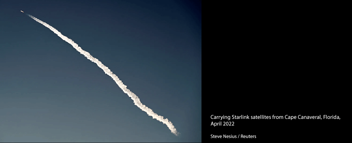
Outside of government use, media outlets, think tanks, and other open-source analysts will continue to fuse commercial satellite imagery with information from other sources and distribute it to audiences around the world, enhancing transparency in ways that can advance state interests by capturing public attention and rallying support for specific causes. Increased transparency, however, can be a double-edged sword. States seeking to keep their activities secret might target commercial satellite firms using cyberattacks, or in extreme cases, conventional military attacks. Russia has already tried—and failed—to hack and jam the satellite-based Starlink service that is the sole Internet provider in parts of Ukraine. In the event of an attack on commercial satellites, the US government might be hesitant to take retaliatory action to avoid escalating a crisis, leaving private satellites vulnerable to continued strikes.
Overreliance on commercial satellite imagery could also pose significant risks, particularly given its accessibility to the public at large. Open-source imagery could be used to spread disinformation rather than combat it: rivals might attempt to manipulate commercial imagery or use artificial intelligence to create deepfakes that tell their preferred narrative. Moreover, just as commercial satellites collect intelligence on the United States’ adversaries, they can just as easily provide information about US military operations to those same adversaries. Although the United States can regulate the activities of US-based satellite companies, its reach may be more limited in preventing foreign companies from revealing sensitive information.
As fighting in Ukraine grinds on, governments, private companies, and citizens alike will need to weigh the tradeoffs associated with this new era of wartime transparency. Political leaders will need to consider the implications of having satellite imagery confirm or contradict their claims about battlefield progress.
Intelligence officials will need to devise best practices for synthesizing classified and open-source intelligence and for sharing this information with allies, partners, and the public. Military planners will need to prepare for a future in which their operations can be detected and disclosed in near-real time by foreign firms that operate beyond the reach of US regulations. The United States should move now to plan for future conflicts that will unfold under the gaze of private satellites.
ERIK LIN-GREENBERG is assistant professor of political science at the Massachusetts Institute of Technology.
THEO MILONOPOULOS is a postdoctoral fellow at Perry World House at the University of Pennsylvania.